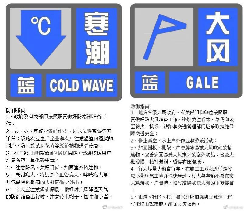
According to Meteorological Beijing News, the Beijing Meteorological Observatory issued a cold wave blue warning signal at 16: 00 on October 2, 2022: due to the influence of strong cold air, it is expected that there will be cold wave weather in Beijing from the 3 rd to the 4 th. On the 4th night, the minimum temperature will drop to about 4℃, and the process minimum temperature will drop by more than 10℃. There is a gust of about 7 on the 3rd, please take precautions.
The Beijing Meteorological Observatory issued a blue gale warning signal at 16: 00 on October 2, 2022: It is estimated that there will be northerly winds of about 4 in most parts of the city from 08: 00 on the 3 rd to 05: 00 on the 4 th, with gusts of about 7, which are relatively obvious in the north and east. Please take precautions.

Day 3 (Monday): cloudy with light rain or sporadic light rain; The northerly wind is about 4 (the gust is about 7); The highest temperature in plain area is 19℃, and the highest temperature in mountain area is 15 ~ 17℃. The minimum relative humidity is 70%.
3 rd night: cloudy to sunny; Northerly winds 3 and 4 (gusts 6 and 7); The lowest temperature in plain area is 8℃, and the lowest temperature in mountain area is 2 ~ 5℃. The maximum relative humidity is 45%.
Day 4 (Tuesday): sunny; Turn north to south wind about level 3 and turn to level 1; The highest temperature in plain area is 15℃, and the highest temperature in mountain area is 11 ~ 15℃. The minimum relative humidity is 20%.
4 th night: sunny; Northerly winds 1 and 2; The lowest temperature in plain area is 4℃, and the lowest temperature in mountain area is-1 ~ 2℃.
Day on the 5th (Wednesday): It will be cloudy between sunny days; Turn north to south wind 2 or 3; The highest temperature in plain area is 17℃, and the highest temperature in mountain area is 12 ~ 16℃.
On the night of the 5th: it will be cloudy between sunny days; South to north wind level 1, 2; The lowest temperature in plain area is 7℃, and the lowest temperature in mountain area is 2 ~ 5℃.
Weather facts and brief description
The actual temperature in the southern suburb observatory ※
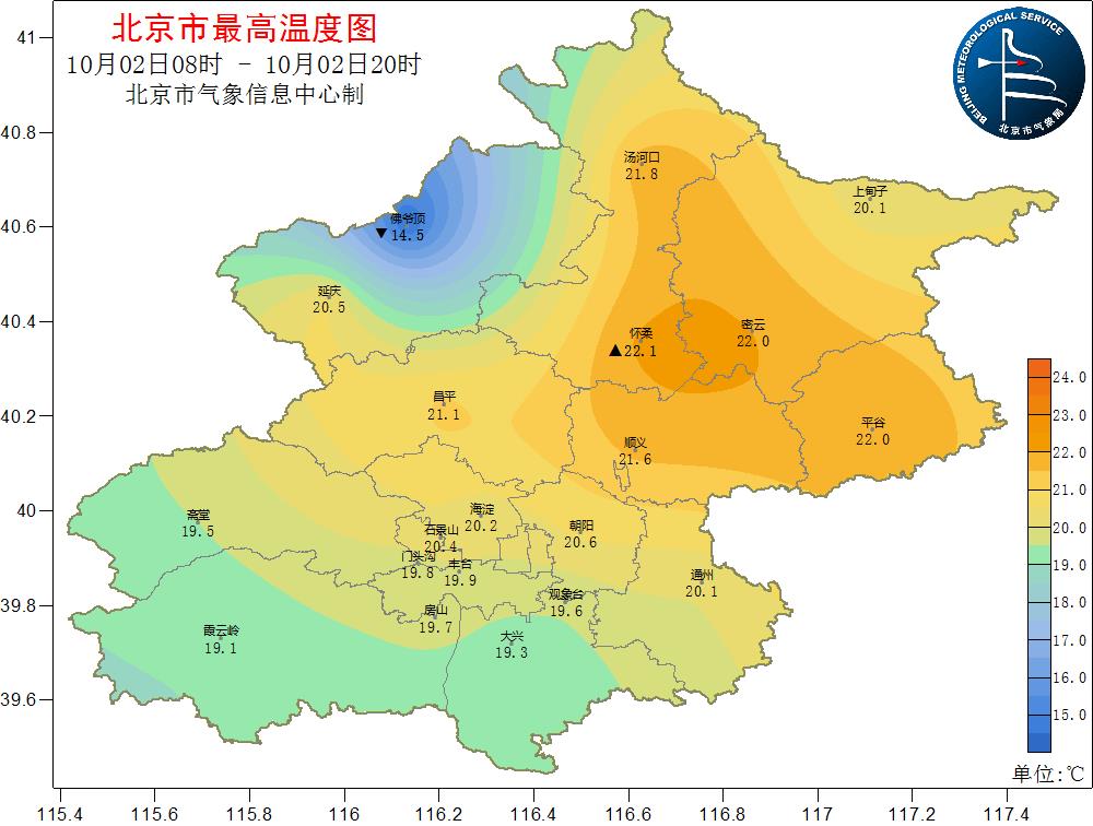
From 08: 00 to 20: 00 on October 2, 2022, the highest temperature yesterday was 19.6 C.
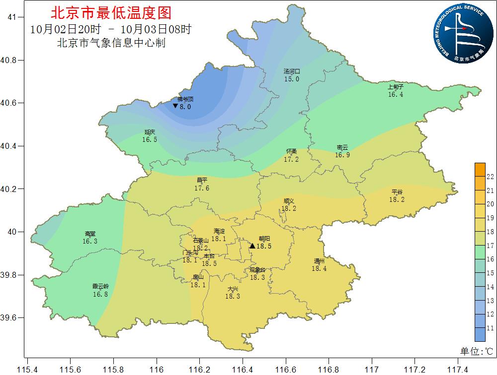
From 20: 00 on October 2nd to 08: 00 on October 3rd, 2022, the lowest temperature this morning was 18.3℃.
Rain express ※
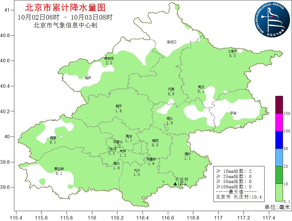
According to the Municipal Meteorological Observatory, the precipitation (mm) from 08: 00 on the 2nd to 08: 00 on the 3rd is 1.2 in the whole city, 1.3 in the urban area (North Korea, Shanghai, Fengfeng, Shijiazhuang, East and West), 3.0 in the southeast (Shanghai, Dalian), 1.0 in the southwest (gate and house), 0.8 in the northwest (Yanchang) and 0.8 in the northeast (Dense).
Note: urban area (Chaoyang, Haidian, Fengtai, Shijingshan, Dongcheng and Xicheng), northwest (Yanqing and Changping), northeast (Miyun, Shunyi, Pinggu and Huairou), southwest (Mentougou and Fangshan) and southeast (Tongzhou and Daxing).

Brief introduction of weather trend
Synopsis of the weather ※
1. In the blue warning of cold wave and strong wind, the temperature of rainy days dropped significantly compared with the previous period.
Today is the third day of the National Day holiday. In the morning, the wind in this city gradually increased to about 4, and the gust was about 7, especially in mountainous areas. At the same time, it is also accompanied by rainy weather. On the day when the wind and rain mode is turned on, the temperature drops obviously under the pressure of cold air. Today, the highest temperature during the day is only about 19℃, which is really a lot colder. In the blue warning signal of cold wave and strong wind, everyone needs to add clothes in time, take rain gear with them, and pay attention to wind, rain and traffic safety.
The rain will last until around the evening, and the roads are slippery. The public should pay attention to the road information in advance, keep a safe distance, slow down and pay attention to traffic safety.
Today, the north wind is strong during the day, the temperature drops sharply compared with the previous period, and the body feels cold. It is necessary to pay attention to adding clothes in time to guard against colds and cardiovascular and cerebrovascular diseases; At the same time, try to avoid mountaineering, camping, and taking outdoor activities such as cruise ships and cable cars. Close the doors and windows indoors, please pay attention to wind and warmth when going out, pay attention to rain and travel safety; The wind gradually weakened after midnight.
Due to the obvious drop in temperature compared with the previous period, it is estimated that the lowest temperature in Mentougou, Pinggu, Miyun, Yanqing and Huairou areas will be below 0℃ at night on the 3rd, which will have an impact on agriculture, so it is necessary to take precautions against crops to avoid and reduce losses. The temperature is low at night on the 4th, and frost may appear in some areas, which has adverse effects on crops, so it is necessary to take anti-frost and anti-freezing measures in time.
On the 2nd, 4th and 7th days, the temperature continued to be low and the body felt cold.
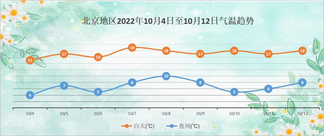
From 4th to 7th, the weather is mainly sunny to cloudy. However, due to the influence of cold air, the temperature continues to be low, and the maximum temperature during the day is maintained at 15~19℃, so the body feels cold. When going out, you should pay attention to adding clothes to keep warm in time, and prepare warm autumn clothes such as long pants and thick coats in advance. When traveling and camping in mountainous areas, you should equip warm clothes such as cotton-padded clothes or thin down jackets, especially the elderly and infirm people should add clothes in time according to the temperature changes to guard against colds and cardiovascular and cerebrovascular diseases. The temperature at night is only 4~8℃. It’s really an autumn rain and a cold ~ Remember to close the doors and windows and cover the quilt at night, and don’t catch cold.

Key weather warning
1. Affected by strong cold air, there is a process of rain, strong wind and cooling in Japan on March 4. At present, in the warning signals of cold wave blue and strong wind blue, you should add clothes in time when going out, pay attention to wind and warmth, take rain gear with you, and pay attention to rain protection and traffic safety.
2. Rains lead to slippery roads, so the public should pay attention to road information in advance, keep a safe distance, slow down and pay attention to traffic safety.
On the 3rd and 4th, the temperature is low at night, and frost may appear in some areas, which has adverse effects on crops, so it is necessary to take anti-frost and anti-freezing measures in time.

Travel weather in the morning and evening
This evening: cloudy to cloudy; Northerly wind level 4 (gusts 6 and 7); 17~14℃。
Tomorrow morning: sunny; Northerly wind level 3 (gusts 5 and 6); 9~12℃。
Meteorological index of daily life tomorrow
The weather index of dressing during the day tomorrow is 4, which is suitable for wearing clothes.
Tomorrow, the daytime comfort meteorological index is 3, and the human body feels cold.
Tomorrow, the meteorological index of ultraviolet rays during the day is 4, and the ultraviolet rays are strong.
The weather index for morning exercise in the daytime tomorrow is 3, which is not suitable for morning exercise.
The meteorological index of car washing during the day tomorrow is 1, which is suitable for car washing.
Tomorrow, the meteorological index of mountain climbing during the day is 3, which is more suitable for mountain climbing.
关于作者